

Fighting Fire
South Central Coastal Information Center Helps Preserve Historical Sites in Peril
November 25, 2008
By Mimi Ko Cruz
As flames charred more than 30,000 acres of land and destroyed hundreds of properties in Anaheim, Brea, Chino, Corona and Yorba Linda, Stacy St. James was called to help identify historical sites in the path of this month’s Freeway Complex Fire.
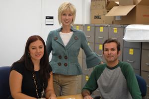
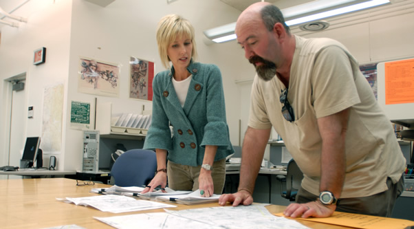
The South Central Coastal Information Center's staff includes, from left, Michelle Galaz, Stacy St. James and Albert Garcia. Photo by Kelly Lacefield
It was 10 a.m. Sunday, Nov. 16, when Cal Fire archaeologist Stephanie Velasquez rang St. James, coordinator of Cal State Fullerton’s South Central Coastal Information Center to request an emergency records search for the location of cultural resources in the fire’s corridor.
“A systematic search was conducted for the known, and projected, fire boundaries,” St. James said, adding that she started feeding Cal Fire information regarding the area at about 11 a.m.
By 4 p.m., her search was complete.
“The main consideration for the records search was to find out the location of known archaeological sites and historic resources so that additional damage to the resources could be avoided, if possible,” St. James said. “Emergency responders conscientiously try to avoid setting up heavy equipment and staging areas in places of cultural sensitivity; bulldozers cutting fire breaks try to avoid rolling over known archaeological sites; and airplanes dropping fire retardant try not to damage historic structures and known rock-art sites.”
The South Central Coastal Information Center, which is based in the Anthropology Department, partners with Cal Fire during emergency situations, she said, “to try to preserve and protect our collective cultural heritage.”
The center is one of 11 that make up the California Historical Resources Information System under the direction of the California Office of Historic Preservation and the State Historic Resources Commission.
Originally housed at UCLA, the center moved to Cal State Fullerton in 2000. St. James runs the center, which employs researchers Thomas Shackford, Michelle Galaz and Albert Garcia.
St. James holds a bachelor’s and a master’s degree in anthropology from Cal State Fullerton. She joined the center as a researcher in 2000 and became coordinator two years ago.
Last year, the center was recognized with a Thomas F. King Award from the Society for California Archaeology for outstanding leadership in the field of cultural resources management.
Between various research projects, including the Cal Fire assignment and a search for records for Southern California Edison this week, St. James talked to us about the center.
Were there any historical sites that burned or that were spared in the Freeway Complex Fire?
I haven’t received any field reports yet and probably won’t for a couple of weeks. But, as I was conducting the records search, there were quite a few archaeological sites and some historic structures that were potentially at risk.
Some of the threatened resources included the location of the historic oil town of Olinda (California Historical Landmark #918), the Bixby-Bryant Ranch House (National Register of Historic Places) and the Area Energy Recreational Building and Picnic Grounds. Prehistoric sites that contained a variety of artifacts, such as hammerstones, manos, metates, scrapers, choppers, cogstones, mortars, pestles, basalt flakes, quartzite cores, bone and shell fragments, also were threatened. The area has had a long and continuous history of human habitation.
How do you conduct a records search?
The center’s transition to digital information management is nearly complete. However, for the Freeway Complex Fire search, the most complete information was found on our paper maps. Protocols need to be developed and agreed upon for the transmittal of sensitive digital information via the web, and while the architecture of such a system is available, it is expensive and funds need to be in place to maintain such a system.
We’ve had past discussions with FEMA, Homeland Security, Department of Agriculture, National Park Service and Office of Historic Preservation to identify the best way to proceed with the transmittal of sensitive information in emergency situations. It is extremely important that site location information does not fall into the wrong hands. We have a responsibility to Native Americans, private property owners and public lands belonging to all citizens to protect cultural resource sites from those who would harm them. Cultural resource managers in California have thus far done an exemplary job of maintaining the security of these resources.
How does the South Central Coastal Information Center operate?
The center enjoys a supportive and collaborative partnership with Cal State Fullerton, the Department of Anthropology and Auxiliary Services, while continuing to provide jobs and research opportunities for CSUF students pursuing careers in cultural resource management and related occupations. We provide students with a working knowledge of the methodologies utilized in the collection and management of cultural resource data in the state of California, with an emphasis on the duties and responsibilities we have as partners in the preservation of cultural resources as mandated by state and federal laws.
The center is responsible for the acquisition, maintenance and dissemination of about 13,000 archeological site and historic property records (including resources listed on the National Register of Historic Places, California Historic Landmarks, California Register of Historic Places and Points of Historic Interest), 16,000 archaeological and historic reports, U.S. Geological survey maps, historic property directories and a professional consultants list for Orange, Los Angeles and Ventura counties. The center also provides information and recommendations regarding such resources on a fee-for-service basis.
Clients of the Information Center include, but are not limited to, members of the general public, researchers, students, developers, engineers, law firms, real estate firms, architects, architectural historians, historic architects, archaeologists, historians, environmental scientists, city and county planners and state and federal agencies with responsibilities under the National Environmental Policy Act, National Historic Preservation Act and California Environmental Quality Act. Clients of the South Central Coastal Information Center are located throughout California and across the country.
How is the center funded?
The center receives an annual $4,000 Historic Preservation Fund Grant from the Office of Historic Preservation. Additional operating budget is generated on a fee-for-service basis and is managed by Auxiliary Services. Total program income is approaching $2 million.