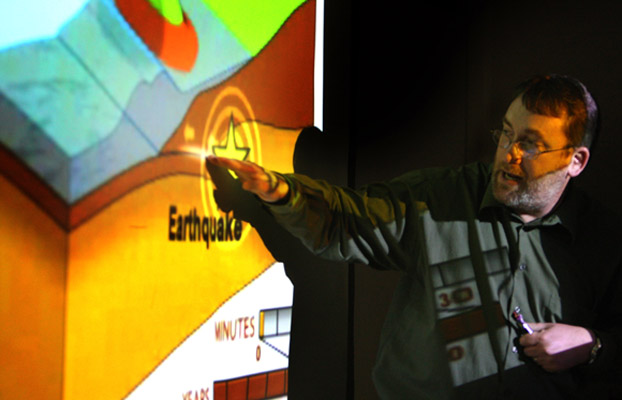
 Caption: David Bowman shows the depth and force of the earthquake on a graphic image during his March 16 presentation. Photo by Karen Tapia
Comprehending Disaster in Japan
Understanding the Power of Earthquakes and Tsunamis
On March 16, David Bowman, chair and professor of geological sciences, and Greg Childers, associate professor of physics, offered an impromptu seminar outlining their initial assessment of the impact of the March 11 earthquake and tsunami, and the ensuing damage to that country’s nuclear power plants. Click here to see the video on YouTube. Below is a transcript of their presentation.
David Bowman: We’re here because there was a big earthquake in Japan. You all know that by now or you wouldn't be here, unless you're here because your 101 instructor told you to be here. The earthquake was a few days ago, March 11. It occurred at 5:46 Universal time — that's 2:46 in the afternoon local time, about a quarter to 10 at night here. It was a magnitude 9.0, which makes it the fifth largest earthquake in the world since 1900. A lot of you have noticed that the magnitude of the earthquake kept on changing. It started out, I think the Japanese initial magnitude was something like 8.4, something like this, and the U. S. Geological Survey said 8.8, now it's up to 9.0. I don't think it's going to change too much from that. It might go up a little bit, maybe to 9.1 but I think probably 9.0 is where we're going to officially determine the magnitude of this earthquake.
The reason that changes so much is because these large earthquakes, an earthquake like this, is so large that our ability to measure the size of the earthquake — we can't use normal seismometers the way we usually do things — and it takes some time to look at the data to figure out what the magnitude actually is. I think this will be stable from now on back to nine. It was a very shallow earthquake, which is why it produced so much damages, why it produced the tsunami that came afterwards.
It's what we call a subduction mega thrust, which I love the term, and the reason we call it that is because this whole zone here that Japan sits upon is where the Pacific ocean is being shoved underneath, across right here that makes up the island of Japan. So that's called subduction and it's a mega thrust because it's thrusting the ocean plate underneath the island of Japan. It was a very large earthquake, the rupture at the surface was about 600 kilometers or 370 miles long. It's huge.
It was a very, very big earthquake and it went about 140 kilometers down into the earth along the fault that broke. So it was a very, very big earthquake, which is why the magnitude was so high for it. This is what I was getting into earlier, if we have my little cartoons running in the background up here. During the process of loading up the island of Japan for producing this earthquake, the ocean plate that's under here is diving underneath the island of Japan. And as it loads like this, it's pulling the coastline down and in the process of having the earthquake, the coastline shoots out in that direction.
And these arrows are actual measurements of how the coastline of Japan has actually moved eastward from the earthquake. You've probably seen in the news people talking about that Japan moved four meters in this earthquake. Well, actually that point moved fours meters in the earthquake to the east. Different points move different amounts.
As you get further away from the fault, the amount that it moved in the earthquake was nothing. Down here on the southern most part of ... actually this ... this is Shikoku is down here, this is a different island. I can't tell which island, this is a terrible map. But this is one of the southernmost islands in Japan — it didn't move hardly at all. These dots are actually direct recordings of the motion in the earthquake on GPS stations and each one of these dots has one of these silver things that looks like a "Dalek" from "Doctor Who."
It's actually a GPS receiver, a really super accurate GPS receiver but the principle is just like what you got in your Escalade, OK? It's a receiver right here with the satellites flying overhead that are always sending position information down to this receiver, but unlike you driving around in your Escalade moving along at 800 miles an hour, this is moving about nine centimeters or so a year very slowly in comparison as the strain accumulates along that subduction zone until a big earthquake happens when it moves all at once several meters, all right?
And that's exactly what that's recording. And inside of the body here they have the different instruments that make up the GPS receiver or record the data. So, each one of these dots has one of those systems. Now that's recording the motion horizontally and that's where you've seen in the news about Japan shifting three meters or something like this. It also subsided some.
The entire coastline of Japan here in the area of the earthquake actually went down quite a lot, subsided. And that's the process when I showed you in the animation where the ocean is diving. ... Let's see, I'll do it from the perspective you're seeing. The ocean is going like this dragging the island Honshu down with it and when the earthquake happens the front, right here on the ocean bottom pops up and the island goes down a corresponding amount.
So that substance is here, it's actually permanent. Although what happens is, over the lifetime of the earthquake cycle as you build up strain towards the next earthquake, that will slowly pull the island down again and pop this part up, so this wiggles up and down over geologic time over a period of hundreds of years, OK? But that and at least for the next few years, next few decades, this is permanently lowered coastline in that area. So, that made the ensuing tsunami even worse because you had areas that they thought, "Well, hey, we're 10 meters above sea level here." Well, after the earthquake they're no longer 10 meters above sea level.
Now, I really enjoyed hearing some members of congress talking about how this earthquake could be felt in Japan, or excuse me, in the middle of the United States.... They could feel this earthquake. Well, no. Seismometers could feel this earthquake in the middle of the United States, you couldn't. But these seismic waves from this earthquake did travel through the whole planet, OK?
So, this I'm going to show you is a close up here of North America and what the earthquake looked like as it came through. This red line here is the path that those waves traveled. It's curved because it's a direct line on a sphere or a map projection. So, that's the shortest pass, this is the initial waves from that earthquake traveled along through here and then hit us in North America.
Now I'm going to show you what happens on this figure. Each dot on here represents a seismometer in place somewhere in the U.S. and the first thing everybody says when they see this is, "Why are these seismometers in the Midwest?" This is actually an experiment that's a very long running experiment that's going on in the earth sciences called ERSCO, that's actually called U.S. Array, and each one of these seismometers, every few months they pick them up and move them east a little bit.
So, this array of seismometers are very slowly marching their way eastwards and recording earthquakes as they happen as they go and the reason they're doing this is because we use these seismometers to make pictures, images of what the inside of the earth looks like underneath North America. Seismometers on here are representing motion up and down. When it turns red that means the ground is actually moving up, when the blip turns blue that means it's moving down.
And on here is the seismogram and you'll see a little red light that moves across marking time in the animation and you'll be able to actually watch the seismogram actually jiggle. This is super cool. So here we go. You see they're all flashing around like random noise and then all of sudden look at those waves come through. Those are the first waves arriving in North America from the seismometer, or from the earthquake. Now you see really strong shaking, dark colored.... You see the waves? Isn't that cool?
So you can see them all popping, getting through like this and then it gets quiet for a little while and there's noise going on, but there's still a lot of shaking going on. What's happening right now is that waves that have actually traveled through different parts of the earth and bounced off different layers inside the earth are coming through. An image that's going to show the aftershocks in the same way but it has a little something extra added to it because these aftershocks all are different sizes.
And in this animation that Allan Jones at SUNY (State University of New York) Binghamton does, he'll play a tone that you'll hear and the tone is proportional to the size of the earthquake. A bigger earthquake, a deeper tone, a smaller earthquake, a higher pitched tone, so you'll actually be able to hear the magnitude of the earthquakes going on, which is kind of cool as you watch the dots go. Those ringing bell are the four shocks. Here's just as they come. That's cool! That's fun! Earthquake music.
So, one of things I want you to notice as you hear that is that the tones. There's big earthquakes happening all through those aftershocks. Even at the very end there were a couple of "bongs" of big aftershocks. I point that out because one of the things that you always see on the news is they'll say, "Well, we just had a big earthquake." And then say after having aftershocks, "But those aftershocks will get smaller through time."
No! It does not do that. What happens is the aftershocks become less frequent through time. But at any given time you can have an aftershock of basically any size. They don't necessarily get smaller through time. They just get less frequent.
This is an example of some of the damage that you'll see. This is in Sukagawa, which is actually inland a bit from where the earthquake was. It's a factory. It was a fragile structure, it was not well-designed, actually. And it did actually collapse in the earthquake, but this was the rarity. There are very few examples of buildings like this. Most buildings stood up to the earthquake without too much problem.
This is an example of a fragile structure. This is the oil refinery just outside of Tokyo, in Shiba City, and this is one of the things you've seen a lot of in the news. This is an example of a fragile structure. Look at these big towers. In an earthquake, they sway, and they can tip over very easily, and there's not a lot you can do about that. They're a fragile structure, and indeed, that's where you get damage.
It's hard to see, but if you look around here at most of these other areas.... Most of the buildings are actually intact after the earthquake.
This was the very first wave of the tsunami coming in, probably a picture a lot of you have seen on TV or in the newspaper. This is in Nitori, which is a town immediately south of Sendai. You can see some of the tsunami.
The coastline here, this coastal plain, is a very flat coastal plain with a lot of agriculture. And so the tsunami, which was about 10 meters high at this area, about 30 feet high.... Wow. All right, that's really big, because it was a very high displacement, big wall of water that propagated inland many kilometers.
I don't think that was particularly expected, that it would go that far. This was a very large earthquake. You can see the tsunami coming to shore here. And this is what produced most of the damage. This is where you see entire city blocks washed away. This is not damage from the earthquake, it's from the tsunami.
However, if you go away from where the tsunami penetrated.... This is in downtime Sendai, only a couple kilometers from the shore, and you can see it looks fine. Right? You'd never know that they just had a magnitude 9.0 earthquake. These are well-designed buildings that stood up to most of the shaking. It's only in places that were low-lying, or that were near river inlets, that the tsunami could concentrate and cause a huge amount of damage.
Most of the buildings stood up well, and I have to say, I feel a little bit frustrated on behalf of my Japanese colleagues, where you see things in the newspaper saying, "How couldn't the Japanese be prepared for this?" Well, the Japanese were prepared. The fact that that building is standing is amazing to me. It just went through a magnitude 9.0 earthquake. You know?
They were prepared, absolutely prepared. Not a heck of a lot you can do for a 30-foot wall of water, though. That's just the way it is.
So, if you look, here's a "before and after" from a city that I'm not even going to pretend to pronounce, on the northern island of Honshu. You can see here, this is a Google Earth image. This is an image that Google Earth took in 2005, and you can see the city here with all the buildings. This is a river valley that goes up in that direction through here. That's the "before" image.
And this is the image that was taken on the 13th, two days after the tsunami, and you can see it's all washed away. The reason why is ... I realize it's kind of dark on the screen ... but there's basically nothing left there.
And the reason that is, is because the coastline here acts as a funnel. As the ocean floor gets shallow, it funnels all of that water into this very narrow area, and it just piles up and wipes out everything in front of it. There's nothing you can do about that, it's just a factor of the geography, which is sobering. And it produces things like this. On top of a two-story building, there's a giant boat. That's really high water from the tsunami.
This was another image that I found. I'm not sure if I was annoyed or amused by this image that kept on showing up in the news. Everybody made a big deal about these whirlpools in the Pacific that are forming from the earthquake, as if the Pacific had a big bathtub thing, and they were pulling the cork out.... All the water's going down.
What they didn't show you, because they very carefully selected the field of their shot, is that there's a big breakwater going right here, and another one going right here. So this is just water that's trapped in a breakwater, spinning around. All right? This is just a local thing that happens in harbors, and if I show you the movies in a little bit of the tsunami coming ashore in Crescent City, California, you'll see whirlpools develop again. It's just a function of the fact that it's in a harbor, and the water can only circulate like this. So don't be fooled by some of the things you see in the media on this.
I just had to put this here, because I was actually emailing with a colleague in Japan, ironically, when the tsunami happened, and got a text message from one of the faculty in the geology department. "Big earthquake in Japan!" And I turned on CNN, and actually watched the tsunami come ashore, and this is an image that will forever be with me.
This house is floating right now. OK? So in the tsunami, this is a burning house that's floating inland. Which is ... I don't have words to describe it, how horrific that is. But all of these things are floating as the tsunami carries it inland, burning and not.
The tsunami propagated through all the areas that are in deep blue color on this map. That's where all the damage is. And I point that out, because especially those of you in the front, let alone those in the back, you can't even see any blue on this. OK? That's just to point out there's... In the news, it sounds like Japan is, you know, dying, the country is falling to pieces. Most of the country was not damaged by this earthquake. All right? You're getting a very slanted view in the media. I know that's shocking.
All of this area right here is where the tsunami surge penetrated inland a couple kilometers, but it's a tiny fraction of the country of Japan. OK? Most of the country was not significantly damaged by the tsunami or the earthquake. I just want to point that out.
Where there is a lot of concern is not so much the buildings and everything else with it, but the impact on the infrastructure, particularly the power. This is where I'm going to hand off to Greg, who is going to talk to you about some of the things you're seeing in the news now.
Greg Childers: Hi, I'm Greg Childers. I'm in the department of physics. Dave asked me to join him for this talk, because... I guess, "asked" by virtue of putting me on the flyer. Because of all the news on the nuclear reactors that's going around Japan right now, that's really dominating the media. In terms of that, there are three power plants. This is the meaningless epicenter of the earthquake that Dave has pointed out. There were three reactors in the vicinity of the epicenter of the earthquake. Onegawa, and then the two Fukushima reactors down here.
Now, as Dave mentioned, there was only moderate damage on well-designed structures. Nuclear reactors are extremely well-designed structures. At the first moment of the earthquake, all the reactors in all three sites immediately shut down. The term for that is "scramming." The control rods were inserted into the nuclear core, completely halting the nuclear chain reaction.
It remains the case for the Onegawa plant, and the Fukushima Two, the Fukushima Dai-ni plant. However, the tsunami hit the Fukushima One plant extremely hard. This is a general picture of the plant from a nice perspective. Here is a slightly different perspective of the plant before the tsunami hit. There are actually six reactors at the site. There are four reactors here, labeled, and then there's two off the frame of the picture.
If these four, Reactors 1, 2, and three are the three reactors that you're hearing a lot about, on possible partial nuclear meltdown. Reactor four is in the news especially today concerning fuel rods held at that reactor. There was news this morning from the head of the US Nuclear Regulatory Commission saying that this pool in Reactor four was empty. Japanese officials respectfully disagreed. I have no clue what's going on there at this point, but if that does go empty, there could be a significant radiation release into the atmosphere.
Right now, prevailing winds put any radioactive plume going out over the Pacific Ocean. That's great. As long as it does that, there is no concern. All the experts that I've seen quoted in the media indicate that the ... Well, most of the radioactive isotopes have very short half-lives. So by the time they reach the US, or even Hawaii, they will have completely decayed.
For those that do not have short half-lives, that have much longer half-lives, including iodine and cesium, those will be extremely diluted in the atmosphere. Worst-case scenario, though.... If all of the fuel rods in Reactor four were to be released into the atmosphere, completely worst-case, the amount of radiation released would be about 1/20 of that released by open-air nuclear tests in Nevada in the 1950s through the early 60s.
So, worst case scenario, radiation going over the Pacific, assuming winds don't change, will be 1/20 of that released over the continental US in the 1950s and early 60s in open-air nuclear tests. So the danger that we have another Chernobyl, that northern Japan is going to become completely uninhabitable, not going to happen. But there is a risk, especially with this cooling pod in Reactor four, that there can be a significant radiation risk into the environment. That's the news to watch right now.
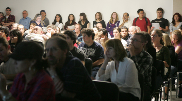 Caption: Faculty, staff and students joined together to hear the talk presented by David Bowman and Greg Childers March 16. Photo by Karen Tapia
March 22, 2011