All Points of the Compass
Geography Symposium Features Address by Remote Sensing Expert
Cal State Fullerton alumnus and remote sensing expert John R. Jensen (B.A. geography ’71) delivered the keynote address at this year’s geography symposium, “All Points of the Compass.”
His talk focused on what remote sensing is, how it is used, how it documents changes in the environment and the myriad careers available in the field.
A video with excerpts from his talk is available on YouTube.
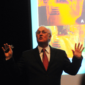 Caption: John R. Jensen talks about his career and how he uses remote sensing during this year's All Points of the Compass symposium. Photo by Mimi Ko Cruz
Jensen, who consults for the Central Intelligence Agency, the National Academy of Sciences and other government agencies, is a Carolina Distinguished Professor in the Geography Department at the University of South Carolina.
In 1968, he took a “photo interpretation” course at Cal State Fullerton that he said led to his life’s work. “I loved it," he said about the cartography course taught by Robert Sager, a longtime geography lecturer. “That course changed my whole life.”
He majored in physical geography and specialized in analytical cartography and remote sensing at CSUF before going to Brigham Young University, where he received his master’s degree in 1972, and UCLA, where he earned his doctorate in 1976. He taught for four years at the University of Georgia before joining the University of South Carolina as an associate professor. At South Carolina, he helped develop a new doctoral program in “Geographic Information Processing,” which specializes in remote sensing, cartography and GIS.
Jensen’s research focuses on:
- remote sensing of vegetation biophysical resources, especially inland and coastal wetlands;
- remote sensing of urban/suburban land use/cover;
- the development of improved digital image processing for classification, change detection and error evaluation;
- assessing the “state of the art” for geographers; and
- the development of educational materials for remote-sensing instruction.
He has received about $4 million in remote sensing grants and contracts, and pioneered the use of remote sensing and GIS for oil spill “environmental sensitivity index” mapping, which is applied to much of the earth’s shorelines.
March 7, 2011
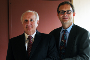 John Carroll, chair and associate professor of geography, who earned his bachelor’s degree in geography from CSUF in 1987, right, greets fellow alumnus John R. Jensen. Photo by Mimi Ko Cruz